

The Azores Meteorological Forecast and Surveillance Center of the Portuguese Institute of the Sea and Atmosphere (IPMA) stated today that at 9:00 a.m. local time (10:00 a.m. in Lisbon), Tropical Cyclone Gabrielle was approximately 2,190 kilometers west of the Azores’ Western group, moving northeast at a speed of 41 kilometers per hour.
Meteorologist Rita Mota from the IPMA’s Azores delegation noted that “at the moment, Cyclone Gabrielle is classified as a category 3 hurricane on the Saffir-Simpson scale” (scale of 1 to 5, where 5 is the most severe category).
“The first effects are expected to be felt in the archipelago starting late Thursday. As Gabrielle approaches the Azores, it is expected to gradually lose intensity, reaching the region with the strength of a category 1 hurricane,” she indicated.
IPMA maintains the forecast that “the center of the cyclone should pass between the Western and Central groups, closer to the Central group islands.”
Based on the current meteorological information, adverse weather conditions are anticipated, particularly in the Western (Flores and Corvo) and Central groups (Terceira, São Jorge, Pico, Graciosa, and Faial), according to IPMA.
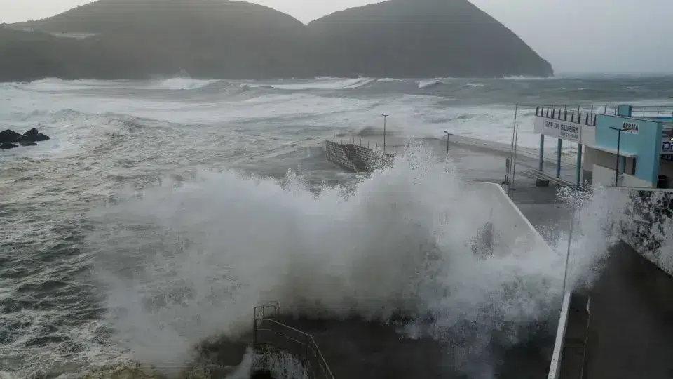
In the Western group, forecasts indicate heavy rainfall, wind gusts up to 150 kilometers per hour shifting from south to north, and maritime agitation with waves ranging from eight to 10 meters in significant height, with maximum wave heights potentially reaching 14 to 18 meters.
In the Central group, heavy rainfall may occur at times, with wind gusts potentially reaching up to 200 kilometers from the south shifting to northwest, and maritime agitation with waves ranging from eight to 10 meters in significant height, with maximum wave heights potentially reaching 14 to 18 meters.
IPMA also states that the Eastern group (São Miguel and Santa Maria) “is expected to be the least affected, with occasional heavy rainfall, wind gusts up to 90 kilometers per hour, and waves varying between six to seven meters in significant height.”
The islands of the Western and Central groups of the Azores will be under a red warning due to heavy rainfall, maritime agitation, and wind, starting Thursday night due to the cyclone’s approach.
For Flores and Corvo islands, the red warning for heavy rainfall is in effect from 9:00 p.m. Thursday (10:00 p.m. Lisbon time) until 6:00 a.m. Friday.
IPMA has also issued a red warning for maritime agitation from midnight to 9:00 a.m. on Friday, with southwest waves shifting to north, and maximum wave heights potentially reaching 14 to 18 meters.
Regarding the red warning for wind on these two islands, it is in effect from midnight to 6:00 a.m. on Friday, blowing from the east and shifting to north.
For the islands of Terceira, Faial, Pico, São Jorge, and Graciosa, which comprise the Central group, a red warning for wind (from south shifting to northwest) is in effect from midnight to 9:00 a.m. on Friday.
IPMA has also issued a red warning for the same group, valid from 3:00 a.m. to noon on Friday, regarding maritime agitation with southwest waves shifting to northwest, and maximum wave heights potentially reaching 14 to 18 meters.