
The storm Gabrielle, after affecting the Azores with numerous incidents and leaving at least 16 people homeless, is now heading to the mainland, promising strong winds. During its passage, it impacted the archipelago with a cyclone intensity and is expected to bring significant weather changes to the Iberian Peninsula.
This phenomenon is anticipated to cause cloudy skies in the northwest of the Iberian Peninsula with abundant high clouds across the rest of the region. Initially expected to pass the Azores as a category 1 hurricane, Gabrielle transformed into a post-tropical storm.
To avoid any unpleasant situations, what precautions should be taken?
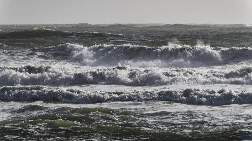
The National Maritime Authority (AMN) has issued several alerts as these types of phenomena strike territories. In the coming hours, it is crucial to adopt self-defense measures at sea, as conditions are expected to be unfavorable.
“Winds from the south quadrant are expected, with an average intensity of up to 85 km/h and gusts reaching 150 km/h,” explained the AMN along with the Navy. They advised the maritime community and the general public to exercise caution, whether preparing for or already at sea, emphasizing the reinforcement of mooring lines and close monitoring of docked and anchored vessels.
Authorities further recommend avoiding seaside walks or areas exposed to marine agitation, such as port jetties, cliffs, or beaches, to prevent being caught off guard by waves.
Another piece of advice is to refrain from recreational fishing activities, especially near cliffs and areas frequently hit by breaking waves, as under these conditions, the sea can easily reach apparently safe areas.
This deterioration is expected to continue until Sunday.
Meanwhile, the National Authority for Emergency and Civil Protection (ANEPC) highlights that strong winds combined with dry and hot land could lead to wildfires.
In response to these forecasts, ANEPC urged the public to strictly comply with wildfire prevention rules, due to the Very High and Maximum risk in the North, Center, and Algarve regions. It reminded that, according to current legal stipulations, extensive burning and pile burning are prohibited.
What does IPMA predict for tomorrow?
Although the effects of Gabrielle are already being felt across the country this afternoon, the Portuguese Institute for Sea and Atmosphere (IPMA) forecasts that tomorrow, Sunday, parts of the coast will be under an orange warning, unlike today, which is under a ‘yellow’ alert.
According to the forecast available on Saturday afternoon on the IPMA website, the districts of Faro, Setúbal, Lisbon, Leiria, and Beja will be under an orange alert from 3 a.m. to 3 p.m. on Sunday.
IPMA stated that the orange warning, the second most severe on a three-level scale, was issued due to the forecast of strong maritime agitation, with waves from the west/southwest between 5 to 6 meters, potentially reaching a maximum height of 11 meters.