

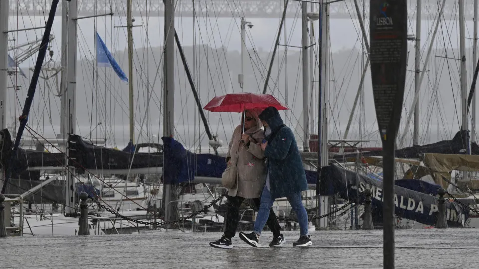
Days after the depression Davide impacted the Portuguese coast with strong maritime disturbance last weekend, rain, wind, and sea turbulence have returned. This time, the depression Emilia is to blame, with even snowfall predicted, not sparing the mountain ranges on the Madeira island.
On Friday, the districts of Guarda and Castelo Branco will be under orange alert due to snowfall predictions above 1400/1600 meters, with accumulations possibly exceeding 25 cm at the highest points of Serra da Estrela.
The Portuguese Institute of Sea and Atmosphere (IPMA) indicates that this warning will remain in effect from 3 AM on Friday until midnight on Saturday.
Throughout Friday, no mainland district will escape the rain, which “may be occasionally heavy, especially in the Center and South, and will fall as snow at the highest points of Serra da Estrela.”
Regarding the wind, it “will blow from the south quadrant, shifting to the east quadrant starting the morning of the 12th, occasionally blowing strongly in highlands,” reports the IPMA in a statement.
Although not directly related to depression Emilia, the entire Portuguese coast will also be under alerts due to predicted strong maritime agitation. Northwest waves of 4 to 6 meters are expected from the morning of Friday, the 12th, until late afternoon on Saturday, the 13th.
North of the Tagus, a yellow alert will be in effect from 6 AM to 6 PM on Friday, escalating to orange until 9 AM on Saturday. South of the Tagus, the alert for maritime agitation will be yellow between 9 AM and 9 PM, turning orange thereafter until 9 AM on Saturday.
In the Madeira archipelago, depression Emilia will cause an “increase in wind intensity from the north quadrant, blowing strong to very strong, especially in highlands, with gusts reaching around 130 km/h, and at the eastern and western extremities of Madeira, with gusts up to 110 km/h, as well as on Porto Santo island, with gusts ranging between 80 and 100 km/h.”
As a result, the IPMA has issued orange alerts, with the most critical period anticipated between late morning on Friday, the 12th, and late afternoon on Saturday, the 13th.
Maritime agitation will also significantly increase in Madeira, with northern waves between 6 to 7.5 meters, potentially reaching maximum heights of 14 meters. Thus, the northern coast of the island will be under a red alert during Saturday’s early hours. The southern coast will be more sheltered, but in the western part, waves between 4 to 6 meters could occur, prompting an orange alert.
As for rain, Madeira will not be spared. Precipitation will be “temporarily heavy during the passage of a frontal surface from the night of the 12th to the 13th, transitioning to showers, which will be more frequent and intense on the northern coast of Madeira and in highlands, occasionally with hail and accompanied by thunderstorms.”
After the cold front passes, temperatures are expected to drop, especially in highlands, “with showers possibly occurring as snow above 1500 meters from the morning of the 12th to the morning of the 13th,” prompting a yellow alert for snow predictions during this period, “with accumulations around 10 cm at the highest points.”
The IPMA further notes that the predicted location of the highest precipitation amounts in this situation “carries very high uncertainty,” hence meteorological warnings might be updated.