
The ‘Activate – Local Communities and the Origins of the Agricultural Landscape of Barroso’ project aims to uncover the history of the World Agricultural Heritage that includes Boticas and Montalegre, in the north of Vila Real district, an area dotted with over 50 fortified villages, known as castros.
“The main objective is essentially to socially activate a heritage that is somewhat forgotten, which are the castros,” archaeologist João Fonte told Lusa news agency.
This significant monumental historical legacy, in his view, “might be in the distant origins” of this World Agricultural Heritage, classified in 2018.
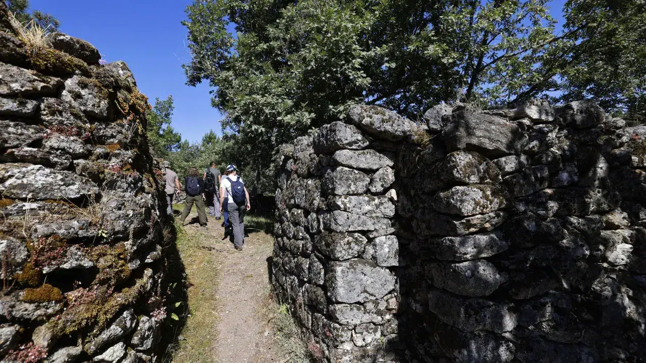
This week, researchers were in the field collecting data, and Lusa accompanied the work at the Carvalhelhos castro in Boticas, which was occupied from the Iron Age to the Roman era.
In this castro, one can see a defensive system composed of two lines of walls, two large ditches, and a field of standing stones. Inside, there are still remnants of circular and rectangular building foundations.
João Fonte explained that a non-invasive mapping of this historical heritage is underway, meaning without excavations, using various techniques such as ground-penetrating radar, magnetometer, drones, and Lidar technology.
The Lidar data is provided by the Directorate-General for Territory (DGT) and involves an aerial scan (with a sensor mounted on an aircraft) that virtually removes the vegetation, allowing the identification of walls or ditches.
“We are also carrying out surveys with dedicated drones in more complex sites,” he noted.
Then, using geophysical techniques like ground-penetrating radar and the magnetometer, it is possible to map buried structures.
“Combining this data will allow us to later reconstruct some of these castros in 3D,” João Fonte further explained.
Archaeologist Tiago do Pereiro managed the magnetometer—a device with five sensors attached to a ‘kart’ and with GPS—taking an underground “X-ray.”
“In this radiography, with this method, we don’t see round houses or square houses; we see those with the radar. What we can see here is that in that area over there, there is probably a furnace or a forge,” he explained, pointing to a tablet with the collected information.
For Tiago do Pereiro, this is a “very important discovery,” previously undetected in excavations conducted last century. In his opinion, utilizing this technology instead of excavations helps protect archaeological sites.
The ‘Activate – Local Communities and the Origins of the Agricultural Landscape of Barroso’ is led by Era Arqueologia, in partnership with the municipalities of Boticas and Montalegre, with funding from the La Caixa Foundation.
Project manager José Carvalho stated that in addition to “activating the castros,” the project also aims to work on memory and identity.
By November 2026, researchers and specialists will work with communities, schools, and local associations. Stories around these sites and the memories of those who live there will be gathered.
José Carvalho mentioned that a website will be created and constantly updated, featuring the “Atlas of the Castros of Barroso.” New routes among the castros may become a new tourist attraction, and a documentary will be filmed.
João Fonte explained that this atlas will function like ‘Google Maps,’ allowing users to click on a point to access information about the castros, virtual reconstructions, and oral memories.
In a later phase, archaeological excavations may be conducted.
“For us, this project is very important and complements the work we have already been doing,” said Nuno Teixeira of the environmental and cultural association Celtiberus, noting that the initiative highlights the “cultural heritage, history, and memory of the region’s people” and that Boticas has enormous potential in terms of castro heritage “that needs to be shown.”