

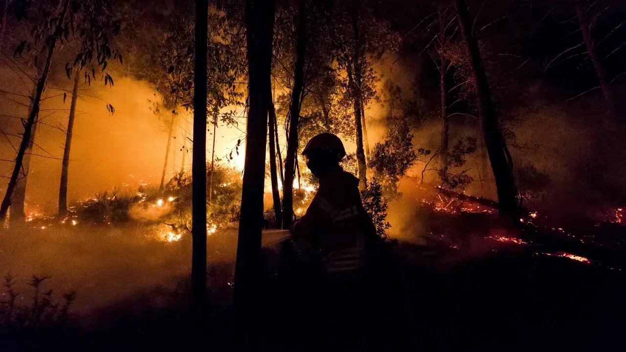
The National Authority for Emergency and Civil Protection (ANEPC) has issued a warning on its website about current bans due to the hot weather affecting the entire country, which is expected to persist in the coming days.
As of early Saturday afternoon, the current situation indicates the country is under orange and yellow warnings due to high temperatures, with the potential for some regions to be upgraded to ‘red’.
Due to the temperature increase, the government has prohibited the use of agricultural and forestry machinery in some municipalities at least until Tuesday.
On its website, the ANEPC outlines the restrictions and where they are in effect. “On days with ‘VERY HIGH’ or ‘MAXIMUM’ rural fire danger, the risk of fire occurrence and spread is higher. On these days, it is essential to exercise all possible caution,” the page states.
The areas under alert can be consulted here.
So, what is prohibited under these warnings?
- Conducting extensive burning;
- Bonfire burning;
- Using fire to prepare food in rural areas, except in non-critical zones and in locations specifically authorized for this purpose;
- Fumigating or disinfecting beehives;
- Launching hot air balloons and rockets;
- Using brush cutters, hedge trimmers, and shredders, all equipment without flame arrestors, cutting tools like chainsaws or mowers, or operating mechanical methods that, through their interaction with materials, generate sparks or heat.
What to expect in the coming days?
According to the latest assessment by the Portuguese Institute for Sea and Atmosphere (IPMA), alert levels will be reevaluated by the end of the day, with the potential to be raised to a higher level, ‘red’, in some districts due to forecasts of heat, even during the night.
The most recent data indicates, especially on the 30th, that temperatures will exceed 40 degrees Celsius in some districts, with very dry conditions and instability, making it hard to control fires if they occur.
Heat… but until when?
From midweek, the situation changes, albeit slightly. At that time, “the flow will tend to shift westwards, with a general decrease in temperatures, although only slightly in the interior regions”.
The “sky is expected to be generally clear until midweek, except for some morning cloudiness along the western coastal strip. Following the wind shift to the west, we will see more cloud cover, and by the weekend, there could be precipitation in the North and Central coast, in the form of light rain“.
The following weekend, on the 5th and 6th of July, “maximum temperatures across the country are not expected to exceed 37ºC”, the institute adds in a note on social media.